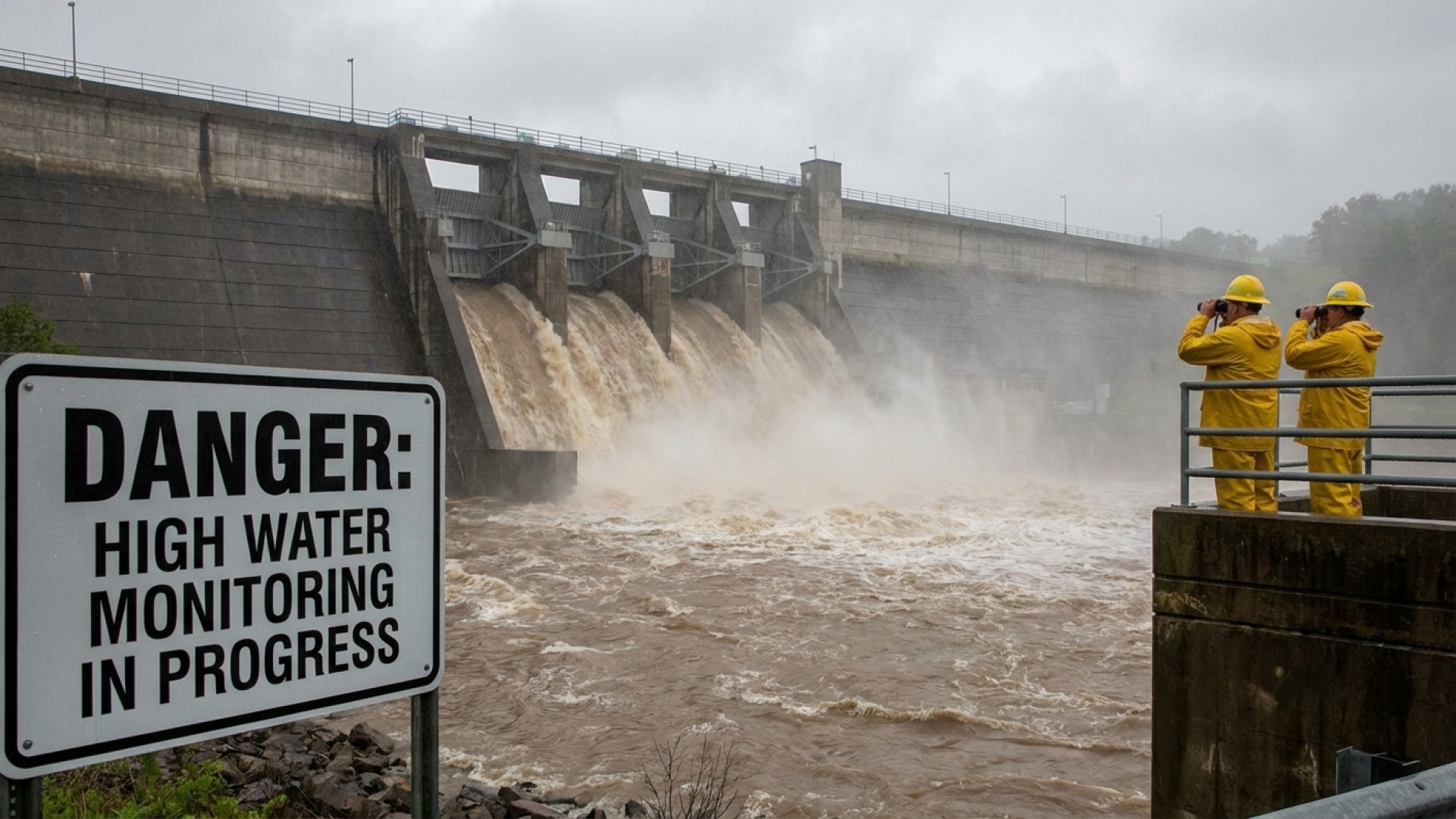
The Genesee River watershed is currently facing a significant hydrological test following a series of intense weather systems across Western New York. Water levels at the Mount Morris Dam, located within Letchworth State Park, have risen substantially, prompting the U.S. Army Corps of Engineers (USACE) to initiate heightened monitoring protocols. As the largest concrete gravity dam east of the Mississippi, the structure is currently serving its primary purpose: protecting downstream communities, including the city of Rochester, from potential flood devastation.
Precision Flood Control in Action
Despite the visual of a surging reservoir, officials from the U.S. Army Corps of Engineers Buffalo District report that the dam is operating exactly as engineered. The facility is designed to hold back excess runoff during peak flow events, releasing it at a controlled rate once river levels downstream subside.
Paul Cocca, the Water Management Section Chief for the Buffalo District, emphasized the routine nature of these operations despite the dramatic change in scenery. “If you go and visit the dam in the summertime, it’s typically very dry and you can see the full face of the dam,” Cocca noted. “Today, you would see a significant pool. But this is precisely what it was built for. We are operating as normal to manage the influx.”
Regional Weather Context: From Runoff to Tornadoes
The surge in water levels is a direct consequence of a volatile weather week for the region. On Tuesday, a rotating thunderstorm escalated into an EF-1 tornado in nearby Cattaraugus County. The National Weather Service (NWS) confirmed that the tornado touched down southwest of Machias, carving a path of destruction through timber and residential areas.
To provide a clearer picture of the recent severe weather impacts that have contributed to the watershed’s current state, the following data highlights the intensity of the storm that preceded the rising water levels:
| Category | Details |
|---|---|
| Event Type | EF-1 Tornado |
| Location | Cattaraugus County (SW of Machias) |
| Peak Wind Speed | 107 mph |
| Path Length | 1.4 miles |
Ongoing Vigilance and Community Safety
The USACE continues to manage controlled releases to ensure the reservoir maintains enough capacity for any additional rainfall. While the volume of water is high, the Lake Erie Times has confirmed through regional authorities that there is no immediate threat to the structural integrity of the dam or to the residents of the Genesee Valley.
As Western New York navigates an increasingly active weather season, the Mount Morris Dam remains a critical piece of infrastructure for regional stability. William Strasmore and our investigative team will continue to monitor the situation at Letchworth State Park and provide updates as the Army Corps of Engineers adjusts their water management strategies.
Disclaimer: The content provided by Lake Erie Times is for informational purposes only and should not be considered as professional legal or financial advice. Some links on Lake Erie Times are affiliate links. This means that if you make a purchase through these links, we may earn a commission at no additional cost to you.